Geofencing using fleet management software: Use cases and benefits
In modern fleet operations, having real-time visibility and control over vehicle movement is no longer optional — it’s essential. One of the most powerful tools that makes this possible is geofencing, a core feature found in most advanced fleet management software. By creating virtual zones on a map, operators can monitor vehicle activity, trigger alerts, automate check-ins, and improve overall operational safety and compliance.
What makes geofencing so impactful is its versatility. From emission zone enforcement in the UK to asset protection in Australia’s remote mining sites, geofencing adapts to regional regulations and industry needs. This blog explores how geofencing works through fleet management software, highlights its use cases across different regions, and outlines the operational benefits it delivers.
What is geofencing in fleet management?
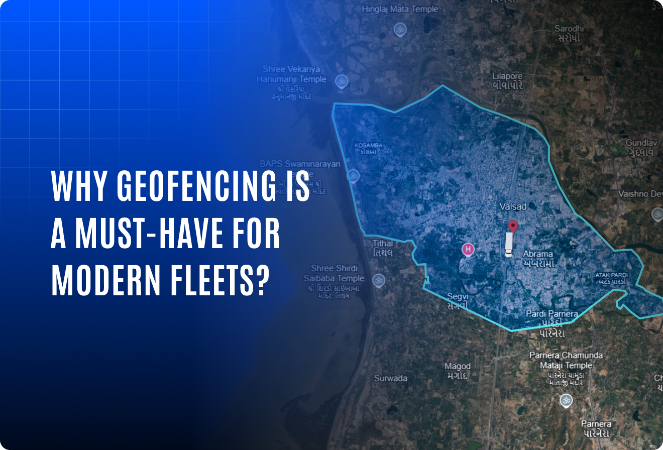
Geofencing is the ability to create digital boundaries on a map. These boundaries can be drawn around landmarks, neighborhoods, job sites, customer locations, or entire cities. When a vehicle enters or exits a geofenced zone, the system records the event and can trigger automated actions like sending alerts, updating trip status, or logging entry/exit times.
Fleet management software makes this process highly efficient. Operators can easily draw geofences on a digital map, tag them with meaningful labels, and assign them to specific vehicles or zones. Geofence data can also be downloaded or linked with reports to analyze how often a zone is visited. Some systems even offer insights like “who was here” showing which vehicles entered a specific location and when. These advanced capabilities turn basic location tracking into actionable intelligence.
While simple in concept, geofencing has a wide range of practical uses. It supports everything from driver behavior monitoring and route compliance to customer service, asset protection, and regulatory readiness.
Geofencing is the ability to create digital boundaries on a map. These boundaries can be drawn around landmarks, neighborhoods, job sites, customer locations, or entire cities. When a vehicle enters or exits a geofenced zone, the system records the event and can trigger automated actions like sending alerts, updating trip status, or logging entry/exit times.
While simple in concept, geofencing has a wide range of practical uses. It supports everything from driver behavior monitoring and route compliance to customer service, asset protection, and regulatory readiness.
Global applications of geofencing
United Kingdom
In cities like London and Birmingham, geofencing plays a vital role in compliance management. Fleet operators use it to mark Ultra Low Emission Zones (ULEZ) or Clean Air Zones (CAZ) so they can track when vehicles enter restricted areas. Alerts and reports generated from these zones help avoid fines and ensure better environmental compliance.
India
Geofencing is widely used in school transport and public vehicle tracking. When a school bus enters or exits a geofenced area like a school or bus stop, alerts can be sent to control centers or even guardians. It’s also used to monitor route adherence in public transport as part of AIS 140 standards.
United States
In the logistics and last-mile delivery sector, geofencing is used to track service accuracy. When a delivery truck arrives at a customer location, a geofence triggers automatic check-in, helping verify on-time performance and reducing manual entry. It also helps monitor sensitive zones such as airports or chemical facilities.
Australia
For industries like mining and agriculture, geofencing ensures that expensive machinery remains within approved boundaries. If an asset is moved outside its zone without authorization, the system instantly alerts managers, helping prevent misuse or theft.
European Union
Across many EU countries, geofencing is applied for cross-border compliance and toll enforcement. Fleets operating across regions use it to avoid entry into restricted zones or to log time spent in toll-based areas for proper expense tracking and regulation compliance.
Practical use cases across fleets
- Route adherence: Alerts are triggered when a driver deviates from a planned route, allowing managers to intervene or investigate.
- Operational efficiency: Automatic check-ins at warehouses or delivery zones speed up workflows and reduce paperwork.
- Safety monitoring: This is especially useful in school and passenger transport, where real-time alerts can indicate if a vehicle veers off its expected path.
- Theft & misuse prevention: Instant alerts if vehicles or machinery are moved outside their designated work zones during off-hours.
- Compliance logging: Entry/exit logs for restricted or regulated zones support audit trails and regional rule enforcement.
How geofencing supports broader fleet goals
- Route optimization
Use geofence entry/exit data to analyze driver patterns, avoid congested areas, and design more efficient routes that reduce delays and idle time. - Fuel efficiency control
Identify unauthorized detours and excessive engine idling within or outside geofenced zones — helping reduce unnecessary fuel consumption and optimize mileage. - Driver accountability
Ensure drivers stay on assigned routes, avoid unscheduled stops, and meet delivery timelines with better monitoring and zone-level behavior tracking. - Enhanced customer experience
Trigger automated check-ins or delivery confirmations when vehicles reach customer locations — improving communication, transparency, and service reliability. - Improved asset utilization
Track how often vehicles or equipment enter/exit key zones to assess usage frequency, improve deployment strategies, and manage resources more effectively. - Data-driven planning
Leverage historical geofencing logs to generate reports that support operational decision-making, audit readiness, and future route planning.
Software-enabled geofencing: Smarter, simpler, and more actionable
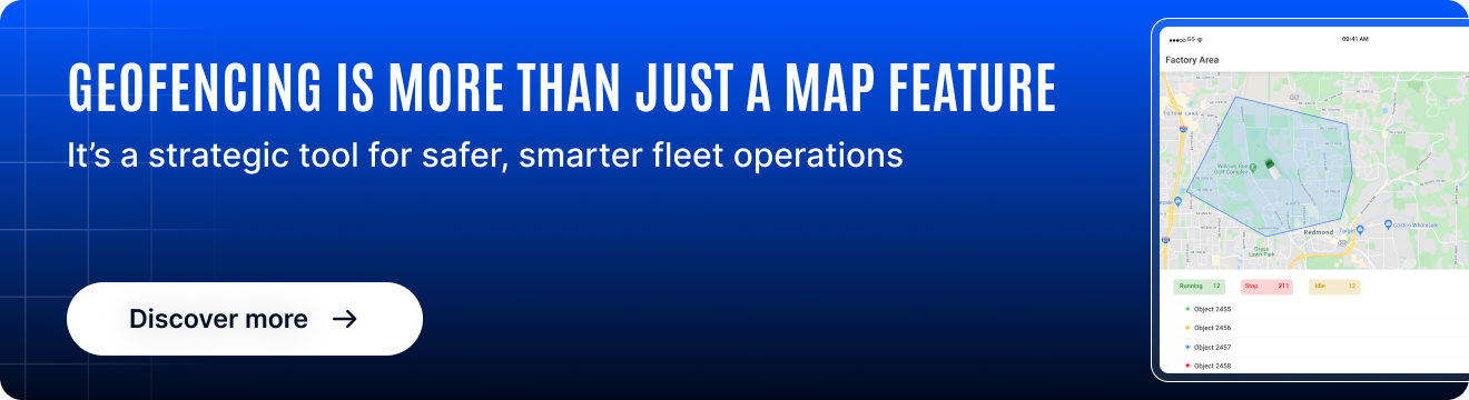
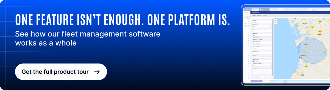
Modern fleet management software doesn’t just allow you to create geofences , it makes the process smarter and far more impactful. Operators can easily draw and configure geofences on an interactive map, assign them to vehicles or zones, and add labels to categorize them by function (e.g., depot, delivery zone, or restricted area).
The software also enables operators to download and store geofence data for reporting or historical analysis. In more advanced systems, features like “Who Was Here?” provide a clear log of which vehicles entered a specific geofence and when, supporting audits, service verification, or investigations.
These software-driven enhancements simplify operational tasks, reduce manual effort, and provide clear visibility across a fleet’s movement patterns. By turning geofences into dynamic, data-rich assets, software helps transform passive zones into active sources of insight.
Why geofencing is a must-have feature
Geofencing might seem like a simple mapping tool, but it delivers strategic value at every level. It increases control, reduces manual oversight, and helps fleets become more responsive and accountable. And because it’s so customizable, it fits perfectly across various sectors; whether you’re delivering goods in urban zones, operating buses for a school, or managing heavy equipment in remote sites.
For fleet operators looking to improve safety, optimize routes, and stay compliant with regional regulations, geofencing isn’t just helpful, it’s essential.
Conclusion
Geofencing brings real-time, location-based intelligence into fleet operations. As global fleets face increasingly local challenges, from emissions zones to operational safety, this tool provides both control and clarity.
No matter where you operate, geofencing adapts to your environment and gives you the visibility you need to stay one step ahead.