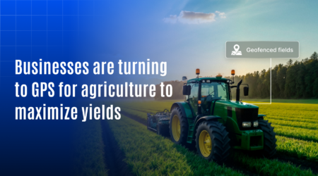
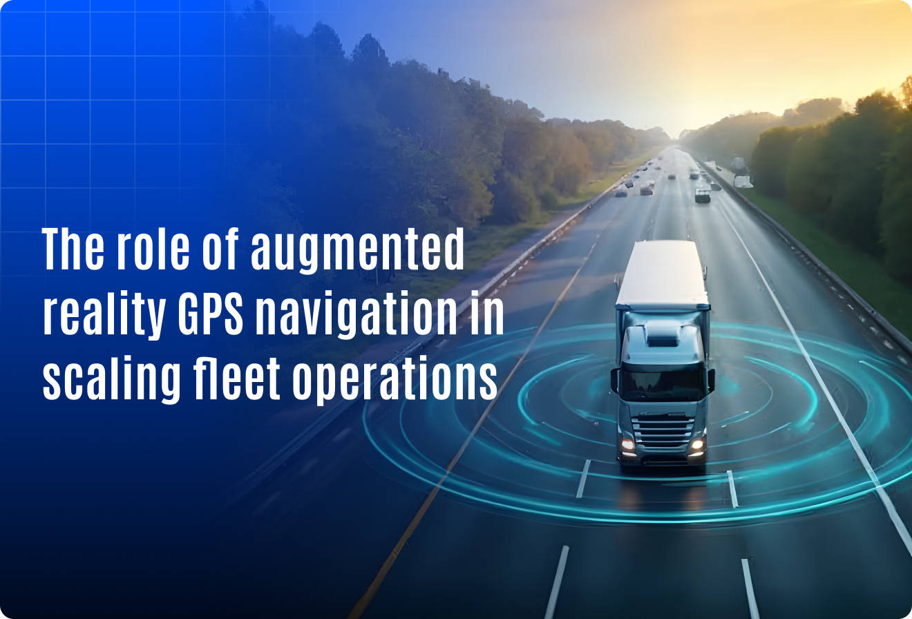
Why Augmented Reality GPS Navigation Matters for Scalable Fleet Operations
Fleet efficiency is no longer optional it’s critical to staying competitive. According to McKinsey, global parcel volumes could double by 2030, putting immense pressure on delivery networks. Even small inefficiencies have major consequences. For example, truck downtime can cost $448 to $760 per vehicle per day, and each failed delivery attempt adds an average of $7.44 in wasted resources.
Yet many fleets are still relying on static maps and outdated routing tools that can’t keep pace with modern delivery demands let alone dynamic traffic, multi-stop planning, or depot-specific guidance. This is where a new wave of innovation is changing the game: Augmented Reality (AR) GPS Navigation.
By combining real-time GPS tracking with AR-powered visual overlays, this technology enables drivers to see routes, alerts, and depot instructions directly on their screens or AR devices reducing errors, improving speed, and scaling efficiency like never before. Whether you operate 20 vehicles or 2,000, AR GPS navigation gives you the edge to scale with accuracy, safety, and speed.
Curious how it works and why your competitors may already be deploying it?
Let’s explore how AR GPS navigation is becoming the backbone of scalable fleet operations.
What Is augmented reality GPS navigation?
Before we dive into benefits, let’s break it down:
- GPS provides your fleet’s real-time location on the map.
- AR overlays digital information (arrows, signs, instructions) on the real world via screens or AR devices.
Together, they deliver real-time guidance and context-aware decision support helping drivers and dispatchers make better choices on the move.
Why augmented reality GPS navigation matters for scaling your fleet
1. Real-time navigation that reduces delivery delays
- Displays live route overlays directly on the screen.
- Shows turn-by-turn directions in real-world view.
- Avoids confusion in complex locations like construction sites or business parks.
Impact: Timely deliveries, happier clients, and fewer support calls.
2. Streamlined last-mile delivery at scale
- Pinpoints exact drop-off points, entry gates.
- Reduces wasted time searching for access points.
- Helps new drivers navigate unfamiliar areas quickly.
Impact: More deliveries per shift and fewer failed attempts.
3. Smarter navigation in private yards and depots
- On large campuses, GPS alone isn’t enough.
- AR shows visual markers for docks, parking bays, or fueling points.
- Improves coordination inside warehouses, plants, or ports.
Impact: Smoother handoffs and less internal congestion.
4. Driver safety and compliance
- AR displays speed limits, hazard zones, and traffic signs visually.
- Encourages on-road discipline without distracting the driver.
- Useful for training new drivers with virtual guidance.
Impact: Safer roads and fewer policy violations.
5. Maintenance made easier
- Technicians can view AR overlays for diagnostics and repairs.
- GPS identifies the vehicle; AR guides repair steps.
- Supports remote assistance in the field.
Impact: Less downtime and faster issue resolution.
Industry use cases
Logistics and delivery
- Boosts route optimization and driver visibility.
Construction fleets
- Helps drivers navigate vast work zones with onsite guidance.
Waste management
- Shows bin locations or pickup points with augmented visual cues.
Emergency services
- Offers real-time hazard alerts and smart routing under pressure.
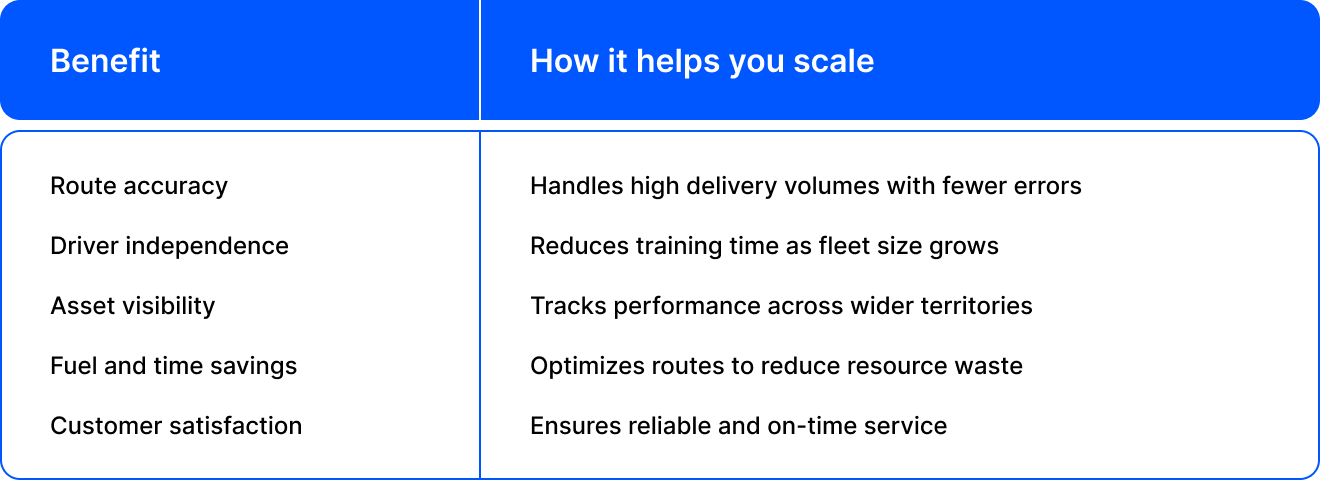
Scaling challenges that AR GPS helps solve
- Difficulty managing multi-location fleets
- Rising costs due to detours or late deliveries
- High driver turnover and training needs
- Inaccurate delivery reports and low client trust
- Navigation issues in dense or restricted zones
AR GPS navigation provides scalable solutions that adapt as your operations expand.
Questions to ask before you implement
- Does the solution integrate with your current fleet management software?
- Can drivers easily use it on smartphones or AR glasses?
- Does it offer real-time updates and route changes?
- Are reports generated for performance tracking?
- Can it handle multi-depot or multi-city fleets?
Future-ready fleets use Augmented Reality GPS navigation
Over the next few years, expect:
- AR-powered windshield displays
- Voice-activated commands
- AI-enhaned route forecasting
- Seamless indoor and outdoor navigation
Companies that adapt now will be better equipped to scale in competitive markets.

Summary
AR GPS navigation offers more than better directions. It provides the tools fleet operators need to scale intelligently, reduce waste, and boost efficiency.
From improving last-mile delivery to reducing training time and enhancing safety, this technology enables fleets to grow without compromising quality or control.
Don’t wait until your systems break under scale pressure. Get ahead now with AR GPS navigation and lead your fleet into the future.